By Atul Aneja
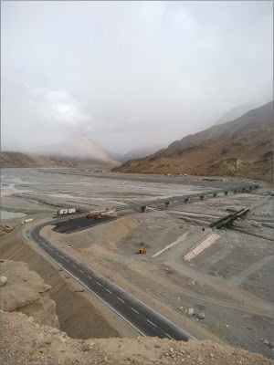
New Delhi, Jan 16 : China has decided to build a road that will link the 800-kilometre Karakoram highway with Astore in Pakistan occupied Gilgit Baltistan, signalling Beijing and Islamabads intent to mount further pressure on Ladakh.
Highly placed sources told IndiaNarrative.com that China wants to connect Yarkand, a former Buddhist fount, and later a cultural heartbeat of the ethnic Uyghur culture, with Astore via the Karakoram highway. Once the 33-meter-wide road is built, China will be able to channel heavy artillery into Gilgit Baltistan, opening the possibility of threatening Indian positions in Ladakh.
Astore district is west of Skardu, a division headquarters of Pakistan, not far from Ladakh, where China and India are locked in an extended military standoff.
With Eidgah as its headquarters, Astore, is one of the 14 districts of Gilgit Baltistan. A low-quality road currently links Eidgah with Karakoram highway, which is 43 kilometres away. Analysts say, the construction of a new road will add to China and Pakistan’s capacity to launch a two-front war against India in Kashmir, unless effectively deterred by New Delhi.
While matching Chinese deployments as well as countering the initial strategic advantage by taking the Kailash range south of Pangong Tso lake on August 29, there are clear indications that India is preparing to mount its riposte not in the Himalayas, but in the waters of the Indo-Pacific.
India, in partnership with Japan and the United States has crossed significant milestones to hit China where it hurts most—along key shipping lanes used by Chinese commercial ships that pass through the Andaman and Nicobar Islands (ANI).
Quietly, India has linked the ANI, with the “fish-hook’ undersea sensors chain, which had been previously marshalled by Japan and the United States to monitor the movement of Chinese ships and submarines in the Pacific.
The ANI are a chain of 572 islands stretching over 800 kilometer north to south at the western entrance of the Strait of Malacca. The straddle one of the most critical naval and trade chokepoints in the world.
The fish-hook network is an extension and advancement over the Sound surveillance system nets (SOSUS) established by the United States in the fifties to monitor ship and submarine movements of the former Soviet Union. It is a more sophisticated SOSUS, which has replaced the older one, to track ships and submarines belonging to the People’s Liberation Army Navy (PLAN) of China.
The system comprises arrays of hydrophones – microphones that are used underwater for recording or listening to underwater sound – and magnetic anomaly detectors on the seabed. These are instruments for detecting minute variations in the Earth’s magnetic field, useful for detecting submarines. These signals are relayed and picked up by maritime patrol planes, equipped to destroy submarines.
The article published by the website resonantnews.com points out that the much-speculated US-Japan fish-hook SOSUS has now touched Andaman-Nicobar Islands, creating a counter- wall against Chinese submarines loitering in the Andaman sea and deep South China sea.
A posting on the website pointed out that India had already set up a network of seabed-based surveillance sensors from Indira point in the Nicobar Islands to Sumatra in Indonesia. For maritime patrolling, the P8I planes, equipped with Harpoon missiles have already been deployed in the Andaman and Nicobar to pick and destroy submarines by linking up with the fish-hook system.
A collaboration with the Indo-Pacific Quad comprising India, Japan, Australia and the United States is on the drawing board to mount real pressure on the Chinese, who are beefing up deployments in Ladakh. If required the goal would be mount a collective effort that can impede Chinese commercial shipping passing through the 10 degree and six-degree channels in the Andaman sea.
“The Six Degree and Ten Degree Channels in the Andaman Sea which lead to the Malacca Strait are vital to the sea lanes of communication (SLOCs) along which flows global commerce, including energy trade, between Asia, Africa and the Pacific. The Andaman and Nicobar Islands are at the intersection of the Indian Ocean and the South China Sea, and further to the Pacific Ocean, an important fulcrum of the strategic concept of the Indo-Pacific,” writes Sujan R. Chinoy, Director General of the New Delhi based Manohar Parrikar Institute for Defence Studies and Analyses.
The 10-degree channel — a major sea lane heading towards the Malacca Straits — a link between the Indian and Pacific Oceans – separates the Andaman from the Nicobar Islands. The vast majority of international trade channelled through Malacca passes through the 200-kilometer-wide Six Degree Channel between the Indonesian island of Aceh and Great Nicobar.
(This content is being carried under an arrangement with indianarrative.com)
Disclaimer: This story is auto-generated from IANS service.

